INKONOVA

Autonomous Mapping and Inspection Robotics with Automated Analytics
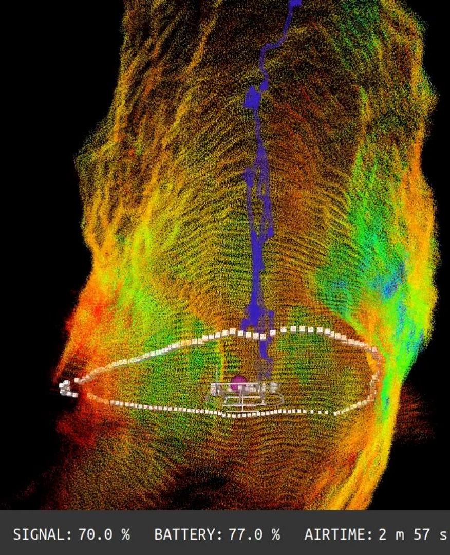
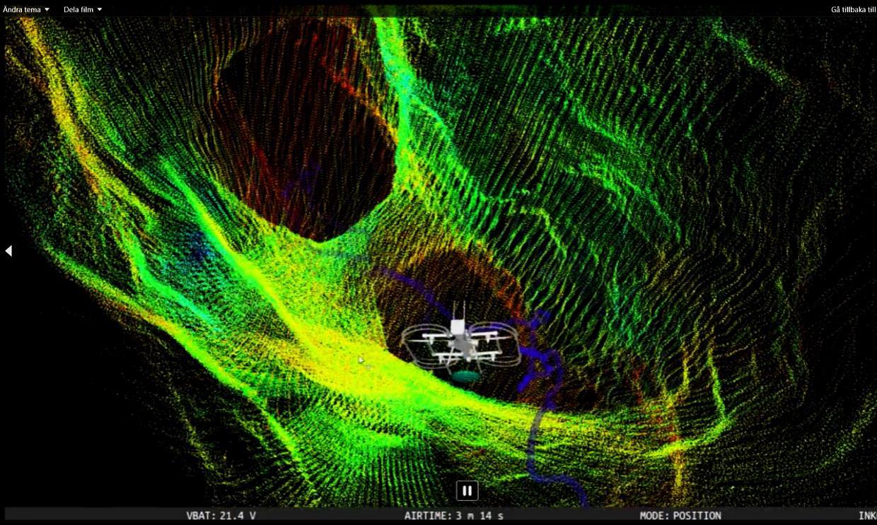
Inkonova offers high-tech, real-time drone technology to enhance the way mines handle inspection, mapping, and data acquisition in their underground environments. Their turnkey solutions feature real-time 3D laser model visualization during operation, non-GPS localization SLAM and 3D pointcloud generation. While precise 3D models are created, the handheld or robotic systems visualize the scanned areas real-time, making exploration beyond-line-of-sight safe and efficient.
The most cost & time efficient way of inspection, mapping & data acquisition in underground mining
Inkonova is a startup that develops drone solutions. Based in Stockholm, it started selling mid-2015 utilizing the tilt-rotor systems for racing drones, creating one of the world’s fastest drones and beating a Lamborghini, before switching focus to becomes the world’s first developer of drone solutions for underground mines.
Inkonova has a principal creed of “Maximum Alleviation of Human Suffering” that guides its strategy, mission and performance metrics.

OPERATIONAL BENEFITS
Reduces carbon footprint
Accelerate production time
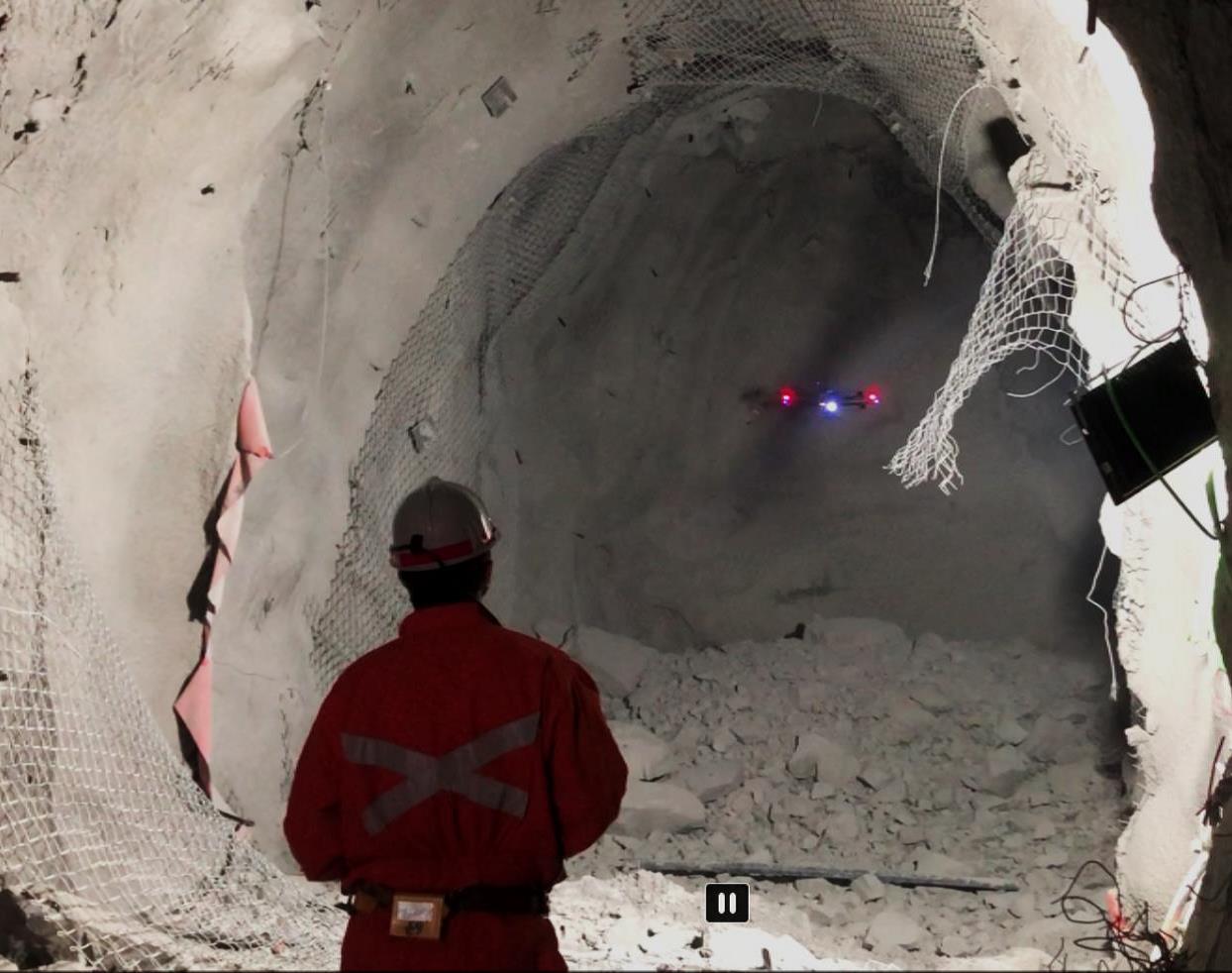
Increases safety of human workforce
Keep surveyors in safe areas and minimize the risks while exploring dangerous zones
Increases operational efficiency, effectivity & profitability
Optimize & Speed up search & rescue missions
Reduces operational costs
Unlock the full potential of inaccessible areas
Optimises Production flow
Optimises preventive maintenance using inspection


- Batonomous Laser Scanning Family
- Flexible Deployment Options
- Access the Inaccessible
- 3D Mapping and Inspection Data Acquisition & Data Processing
- Smart and Intuitive Operation
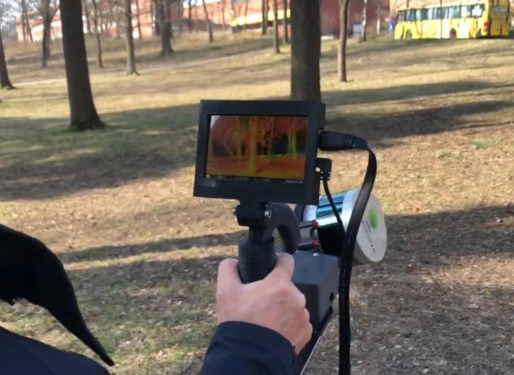
- Aerial (drone) and ground (handheld, vehicle) versions
- Get Surveys Safer, Faster & Further
- A cost-efficient way of gathering critical data and decision-making support
- Semi-autonomous workflow:
- Prepare safe mission (assemble and arm)
- Execute multiple-task mission:
- Navigate, gather, process and display all simultaneously
- Deliver immediate results: download data directly after landing
- Drone Enabled
- Handheld
- Vehicle mounted (optional)
- Back Pack mounted (optional)
- Reduce number of hours surveyors spend underground
- Free surveyor time to focus on higher value tasks
- Unlock the value and potential of old mines
- Increase the decision-making process by use of real time data
- Safely survey and inspect old mines to inspect geological structures to optimize mining design
- Autonomy Level 1 (equivalent to GPS Position Hold but UG)
- Autonomy Level 2 (waypoint navigation)
- Autonomy Level 3 (fully autonomous exploration)
- Automated cloud merging software for increased efficiency and merging precision
- Dual SLAM 3D Mapping package for superior system reliability
- Real Time Visualization and in-flight point cloud processing to save time with instant 3D map availability.
- Insightful app interface for user friendly access to maps and operations
- Automated geo-reference control points extraction for easy and precise geo-positioning
- Collision avoidance system (against static and moving objects) for safe and confident piloting
- Internal flight logging for journey record keeping
- Battery Warning System for secure operation
Application Examples
Monitor and maintain ore-passes and shafts
- The heart of material transport . Conditioned ore-and waste-passes drastically reduces transport carbon footprint
- Monitor shafts and rock/waste passes
- Flow optimization
- Proactive reconditioning
Accident Analysis and Assessment
Optimize post-incident analysis with automated aerial inspection for better decision making and faster production ramp up time.
Inaccessible UG scanning
Volume calculation of stock pile
Autonomous Exploration
Integration into Mining Workflow
Predictive maintenance: automated/ai Information extraction
Geotechnical Structure Detection

About Inkonova
Based in Stockholm, Inkonova began innovating tilt-rotor systems for racing drones in 2015, creating one of the world’s fastest drones (faster than a Lamborghini) before switching focus to becomes the world’s first developer of drone solutions for underground mines. Today, Inkonova develops both underground robotics for inspection as well as 3D mapping solutions with SLAM-based technologies.
At RAMJACK Technology Solutions, we offer solutions from Inkonova™ to clients in Africa, Europe, the Middle East and Latin America.