uGPS Rapid Mapper™

Underground Scanning of Tunnels & Shafts
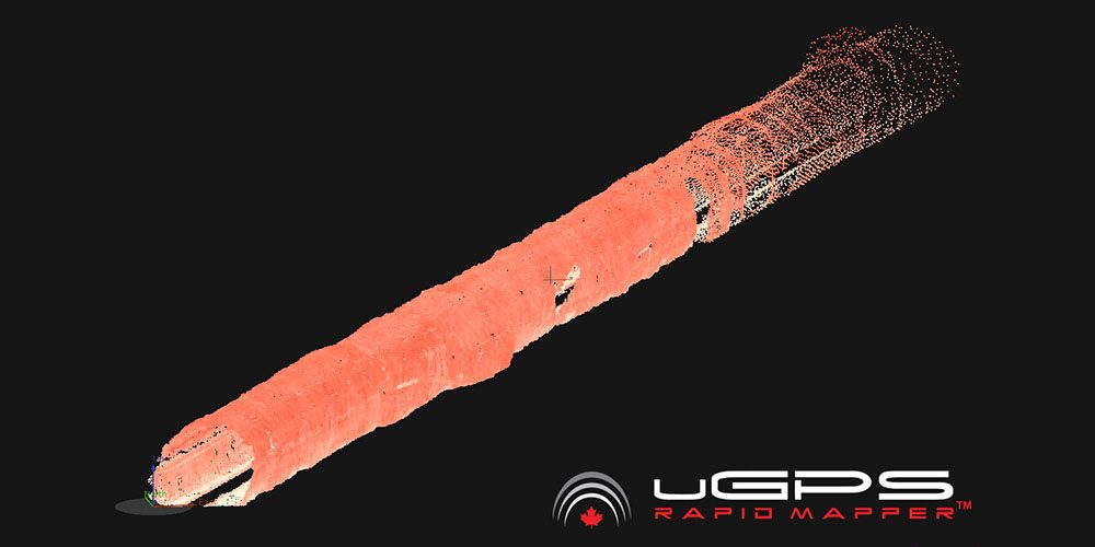
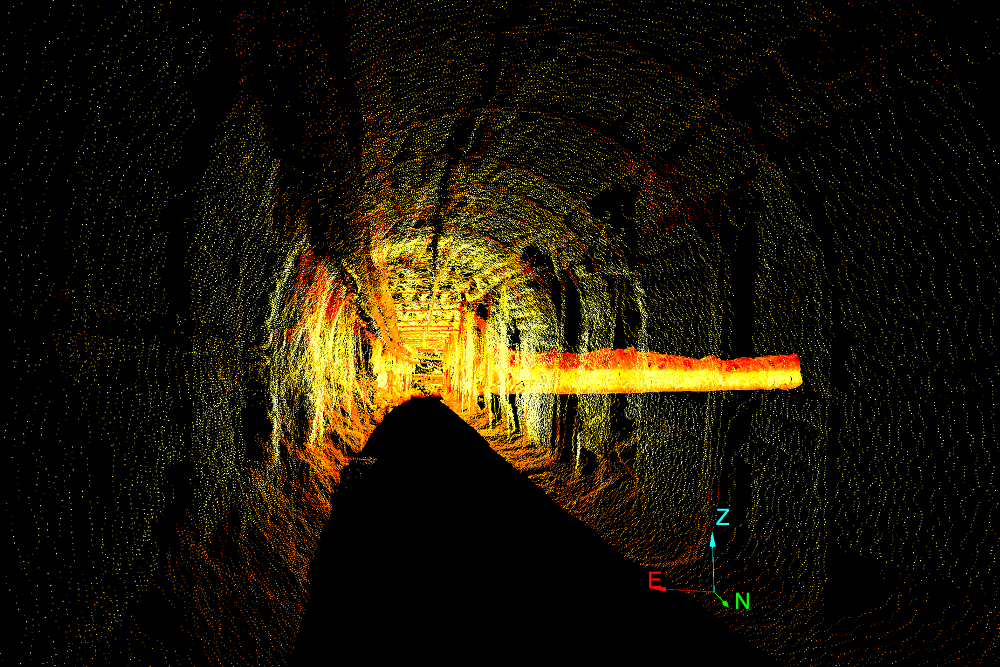
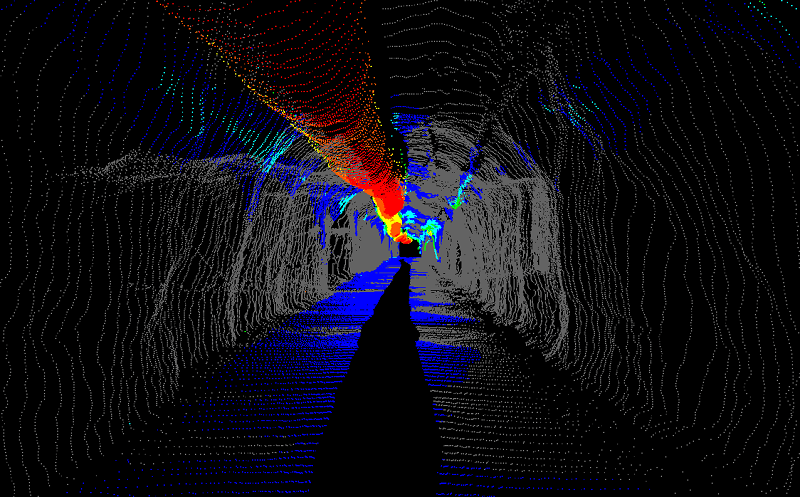
Mobile mapping platform creating a rapid point-cloud representation of underground tunnels and shafts for projects, planning, and operations. The uGPS Rapid Mapper™ is a revolutionary laser-based mobile tunnel mapping tool developed for underground mining applications. Easily map your mine while operating mining vehicles – uGPS Rapid Mapper™ provides rapid 3D point cloud data acquisition purpose-built for underground mines and is specifically designed for easily inputting data into mine planning applications.

uGPS Rapid MapperTM is your accurate, easy-to-use and reliable solution for underground mine mapping
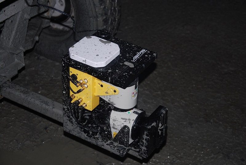
The uGPS Rapid Mapper™ was purpose-built for underground mines, and its ease-of-use and rugged construction makes it ideal for demanding mining environments. Running on a single cable (power), uGPS Rapid Mapper™ can perform rapid open-loop scans to collect kilometres of point cloud data in as long as it takes to drive the tunnel. The data can also be easily geo-referenced to mine coordinates for closed-loop scans, making it the perfect technology for balancing accuracy with speed.
This balance, and the fact that it doesn’t require specialised skills to operate, makes uGPS Rapid Mapper™ a convenient tool for engineers and planners to get timely feedback from underground workings. Data is easily exported using either a wireless internet connection or a USB device and then easily imported into a wide range of third-party software packages.
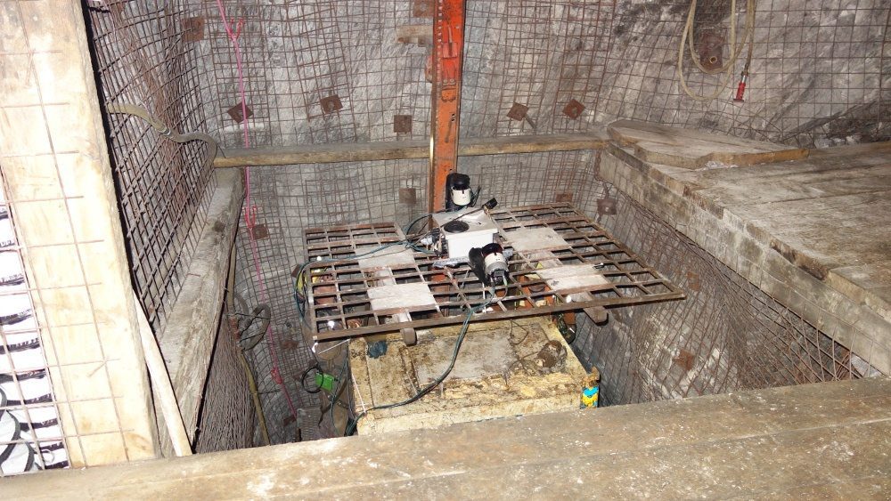
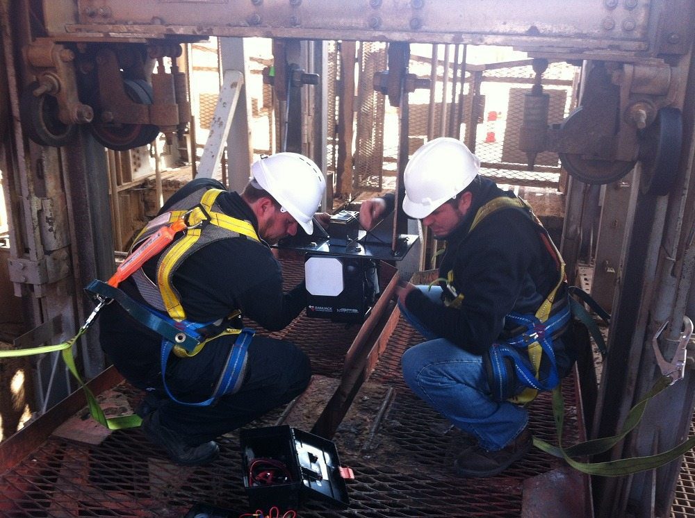
Applications include: the augmentation of routine shaft inspections with a uGPS Rapid Mapper™ 3D point cloud, using volume calculations to compare actuals to plan or determine whether a piece of equipment will fit through an underground opening, or reducing delays associated with non-routine survey pick-ups and as-builts.
Regardless of how you use the uGPS Rapid Mapper™, it will deliver clear, highly detailed data, enabling your mine surveyors, planners and engineers to make informed decisions, quickly and confidently. At RAMJACK, we are proud to bring this ground-breaking technology to our African, European & Middle Eastern clients. Contact us today to find out more about how the uGPS Rapid Mapper™ has changed surveying technology for the better.


Map Your Mine While You Drive

The uGPS Rapid Mapper™ has evolved over time to focus on mobile tunnel mapping. Today, it offers mining operations a revolutionary tool for their projects that can increase operational capacity and safety.
With geotechnical uses, planning uses, shaft/raise uses, and ventilation uses, the uGPS Rapid Mapper™ is a multi-functional tool beneficial for many underground mining applications.

The uGPS Rapid Mapper™ is a cutting-edge mobile scanning unit with 3D tunnel mapping and surveying capabilities that streamline and simplify underground mining operations like never before. Featuring state-of-the-art hardware for unprecedented performance, this mining tool comes with an inertial sensor, onboard computer, Wi-Fi connectivity, and more.

At RAMJACK Technology Solutions, we offer solutions from uGPS Rapid Mapper™ to clients in Africa, Europe, the Middle East and Latin America.